Strategic cycle network map, London
The strategic cycle network map
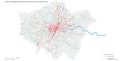
This is the capital's "strategic cycle network". The thick red lines are the existing routes - the Cycling Superhighways and Quietways, that have been spreading across the capital over the last few years. The thin red lines are those that are currently planned, and the green dotted lines are possible later connections.
If all this is delivered, the strategy says, 70 per cent of Londoners would live within 400m of a cycle route - a distance you can cycle in a couple of minutes.